Log in
All resources
Create a design
9,296 Free Artworks of Map Collection
bibliothèque nationale de france
maps of paris from bibliothèque nationale de france
turgot map of paris, bibliothèque nationale de france
eran laor cartographic collection
koninklijke bibliotheek
latin-language maps
1667 maps
copper engraving print
british library
joan blaeu
den danske hærs historie til nutiden og den norske hærs historie indtil 1814
maps from the mechanical curator collection
adolf eltzner, svate mesto jerusalem za casu krista pana, 1864
eran laor cartographic collection
adolf eltzner, svate mesto jerusalem za casu krista pana, 1864
eran laor cartographic collection
eran laor cartographic collection
daniel friedrich sotzmann
adolf eltzner, svate mesto jerusalem za casu krista pana, 1864
eran laor cartographic collection
eran laor cartographic collection
guillaume dheulland
17th-century maps of europe
latin-language maps
bodleian maps collection
leo belgicus
coats of arms of perpignan
baroque painting,baroque
den danske hærs historie til nutiden og den norske hærs historie indtil 1814
maps from the mechanical curator collection
map of amsterdam, 1544
ink and paper
hoogheemraadschap rijnland map, 2nd edition, 1687
linen
st. helena - a physical, historical, and topographical description of the island (1875) by melliss
maps from the mechanical curator collection
ice-bound on kolguev (1895) by trevor-battye
maps from the mechanical curator collection
turgot map of paris, bibliothèque nationale de france
maps of paris from bibliothèque nationale de france
turgot map of paris, bibliothèque nationale de france
maps of paris from bibliothèque nationale de france
turgot map of paris, bibliothèque nationale de france
maps of paris from bibliothèque nationale de france
turgot map of paris, bibliothèque nationale de france
maps of paris from bibliothèque nationale de france
turgot map of paris, bibliothèque nationale de france
maps of paris from bibliothèque nationale de france
turgot map of paris, bibliothèque nationale de france
maps of paris from bibliothèque nationale de france
turgot map of paris, bibliothèque nationale de france
maps of paris from bibliothèque nationale de france
turgot map of paris, bibliothèque nationale de france
maps of paris from bibliothèque nationale de france
turgot map of paris, bibliothèque nationale de france
maps of paris from bibliothèque nationale de france
19th-century maps of oxfordshire
bodleian maps collection
turgot map of paris, bibliothèque nationale de france
maps of paris from bibliothèque nationale de france
turgot map of paris, bibliothèque nationale de france
maps of paris from bibliothèque nationale de france
turgot map of paris, bibliothèque nationale de france
maps of paris from bibliothèque nationale de france
turgot map of paris, bibliothèque nationale de france
maps of paris from bibliothèque nationale de france
turgot map of paris, bibliothèque nationale de france
maps of paris from bibliothèque nationale de france
turgot map of paris, bibliothèque nationale de france
maps of paris from bibliothèque nationale de france
turgot map of paris, bibliothèque nationale de france
maps of paris from bibliothèque nationale de france
turgot map of paris, bibliothèque nationale de france
maps of paris from bibliothèque nationale de france
turgot map of paris, bibliothèque nationale de france
maps of paris from bibliothèque nationale de france
turgot map of paris, bibliothèque nationale de france
maps of paris from bibliothèque nationale de france
turgot map of paris, bibliothèque nationale de france
maps of paris from bibliothèque nationale de france
maps from university of amsterdam special collections
atlas der neederlanden
maps of london by braun & hogenberg
eran laor cartographic collection
maps of santander by braun & hogenberg
eran laor cartographic collection
eran laor cartographic collection
maps of lyon by braun & hogenberg
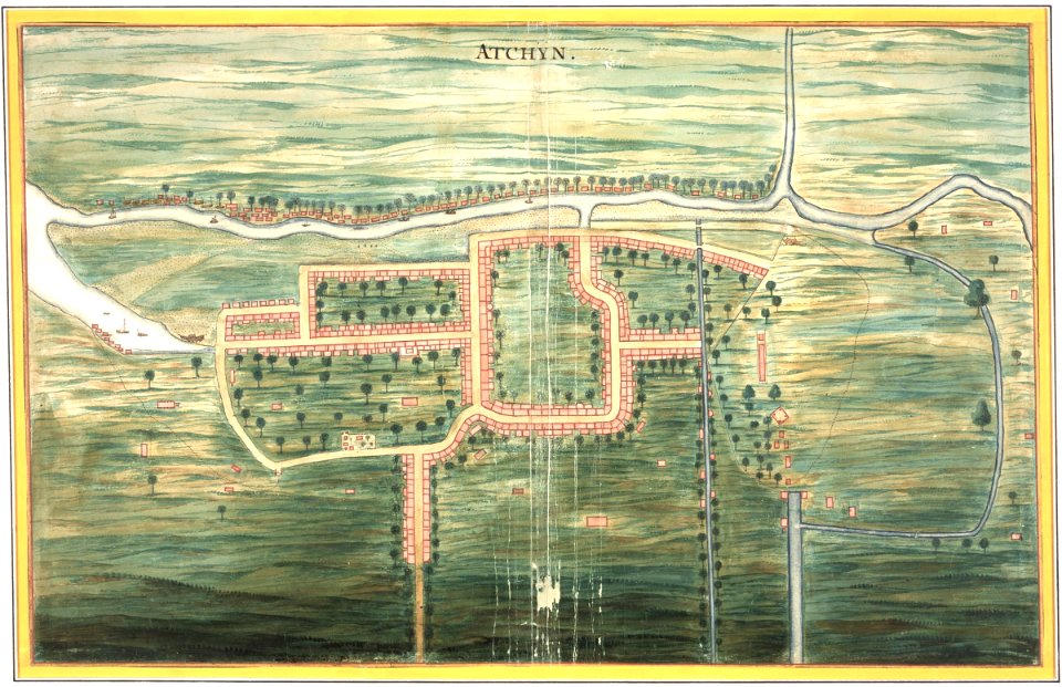
maps of the dutch east india company - indonesia
watercolor drawings by johannes vingboons
maps of the west-indische compagnie
1682
maps by pieter van der keere
1610s maps of belgium
synopsis universae philologiae
1741 maps of europe
maps of the history of the united states
old maps of the british empire
maps of tangier by braun & hogenberg
maps of safi by braun & hogenberg
maps in the british museum
1610s maps of ireland
maps by pieter van der keere
old maps of basel
maps by matthäus merian
baroque
maps in the british museum
battle of fontenoy
maps by tobias conrad lotter
maps by tobias lobeck
tresor des cartes geographiques (1659)
1650s maps of india
17th-century maps of france
maps of touraine
maps from gallica
maps of tlemcen
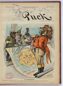
1898 covers of puck magazine
drawings of scissors
victor levasseur - maps of the world
french algeria
maps of alsace by guillaume sanson
1700s maps of alsace
coats of arms of cities in nièvre
andré dupin
maps from the mechanical curator collection
1855 maps
16th-century double hemisphere world maps
1590s maps of the world
old maps of vermandois
old maps of santerre
18th-century celestial maps
1708 maps
1660s maps of spain
1667 maps
1660s maps of spain
1667 maps
1660s maps of spain
1667 maps
1660s maps of spain
1667 maps
1660s maps of spain
1667 maps
atlas maior, vol 11 (asia) - joan blaeu, 1667 - bl 114.h(star).11
1667 maps
maps of ancient italy by philipp clüver
eran laor cartographic collection
maps by pieter schenk (i)
maps by gerard valck
eran laor cartographic collection
clara filleul
eran laor cartographic collection
edward weller
maps of ghent by armand heins
map of expo 1913
maps in the staats- und universitätsbibliothek hamburg
1852 maps of hamburg
1780s maps of portugal
maps by tomas lopez
18th-century maps of the azores
1780s maps of portugal
maps of spain by tomas lopez
1779 maps of spain
1770s maps of portugal
1770 maps of spain
maps of spain by tomas lopez
old maps of lanzarote
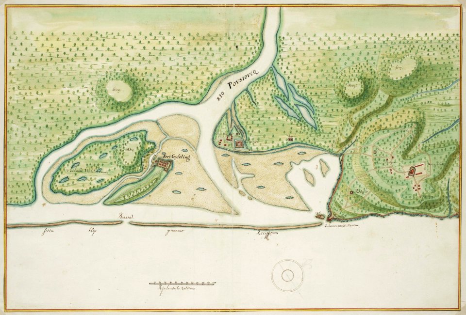
maps of the west-indische compagnie
old maps of dutch brazil
brazilian paintings in the museu antônio parreiras
antônio rafael pinto bandeira
maps of ghent by braun & hogenberg
moll's map collection
west seram regency
johannes nessel
old maps of the dutch east india company
anthonie de winter
walter riemer (illustrator)
pictorial maps of germany
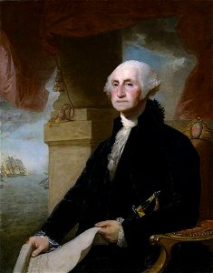
lansdowne portrait of george washington
neoclassicism
maps of the west-indische compagnie
1747 maps
maps by jakob van der schley
1753 maps
eran laor cartographic collection
german renaissance,humanism
eran laor cartographic collection
german renaissance,humanism
eran laor cartographic collection
thesaurus philopoliticus
maps of the west-indische compagnie
1671
maps of the dutch east india company - indonesia
17th-century maps of bavaria
maps of the dutch east india company - south africa
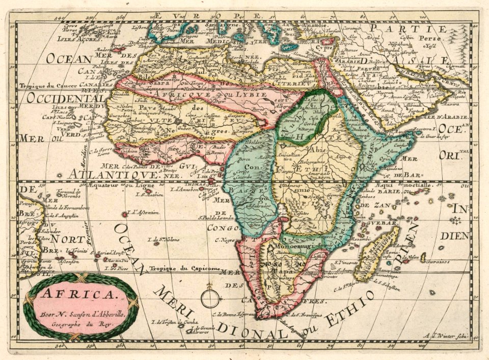
1747 maps of africa
old maps of the dutch east india company
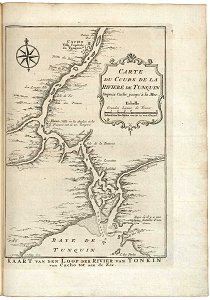
trịnh lords
civitates orbis terrarvm, liber primvs (1577)
maps of tangier by braun & hogenberg
media from the national library of finland
classicism
media from the national library of finland
classicism
hoogheemraadschap rijnland map, 2nd edition, 1687
gemeenlandshuis zwanenburg in art
maps from university of amsterdam special collections
atlas der neederlanden
maps from university of amsterdam special collections
atlas der neederlanden
1301 - 1400 of 9,296
Next page
/ 93